Steinhuder Meer Rundweg

- 3:00 h
- 32.00 km
- 13 m
- 16 m
- 34 m
- 54 m
- 20 m
- Start: The circular route can be started at any point.
- Destination: Der Rundweg kann an jeder beliebigen Stelle beendet werden.
In the Steinhuder Meer vacation region, cycling is the most popular vacation activity alongside swimming. No cyclist would miss the chance to cycle around the Steinhuder Meer at least once on the excellently developed loop trail. The approximately 32-kilometer-long tour connects the surprisingly numerous cultural and, above all, scenic highlights around the lake. This means you can easily spend a whole day on and off the loop trail. Along the way, you’ll also find several information signs with interesting facts about the nature park and the specific location—an invitation to pause now and then and take in the surroundings even more fully. This way, you can easily spend a whole day on and off the loop trail.
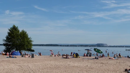
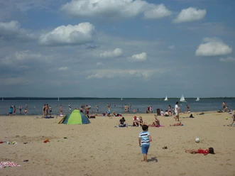
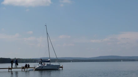
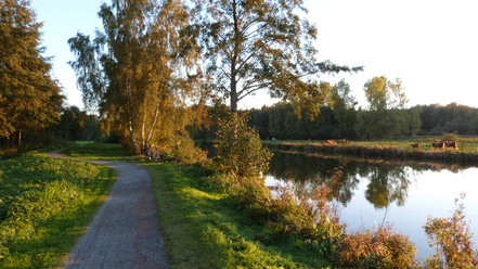
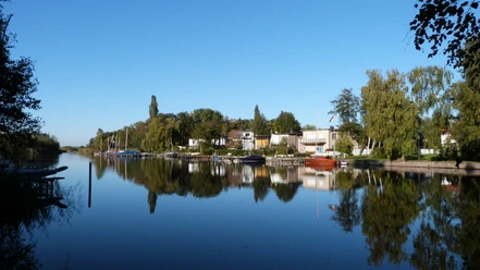
On this route, whether by bike or on foot, you’ll explore diverse landscapes that frame the great lake like a sparkling gem. The shoreline will change its appearance several times during your hike. At times, trees line the very water’s edge; at others, belts of reeds dominate; then the flat foothills of a large dune extend into the water, forming a fine sandy beach. You’ll travel in the shade of a forest that eventually opens up to vast wet meadows. Later, you’ll reach a primeval-like alder swamp forest—a paradise for songbirds and waterfowl—which you can explore via a paved boardwalk.
On this route, whether by bike or on foot, you’ll explore diverse landscapes that frame the great lake like a sparkling gem. The shoreline will change its appearance several times during your hike. At times, trees line the very water’s edge; at others, belts of reeds dominate; then the flat foothills of a large dune extend into the water, forming a fine sandy beach. You’ll travel in the shade of a forest that eventually opens up to vast wet meadows. Later, you’ll reach a primeval-like alder swamp forest—a paradise for songbirds and waterfowl—which you can explore via a paved boardwalk.


Waypoints
Start


Good to know
Pavements
- Street (12%)Asphalt (47%)Gravel (24%)Trail (17%)
Best to visit
- suitableDepends on weather
Directions
- Steinhude - Hagenburg - Winzlar - Rehburg - Mardorf - Neustadt a. Rbge. - Großenheidorn - Steinhude or vice versa.
Route markings
- Die Tour ist in beide Richtungen mit dem Logo des Rundweges beschildert.
Directions & Parking facilities
- Getting thereIf you want to reach the southern shore of Lake Steinhude, you can take the Wunstorf/Luthe or Wunstorf/Kolenfeld exits from the A2. The B441 and B442 will take you to your destination.
You can reach the northern shore of Lake Steinhude in various ways. From the A2 highway, take the B6. Coming from the A1 or A7 highway, you can reach the north shore via the B214 and B6. Leave the B6 at the Neustadt a. Rbge exit and follow the signs to your destination.ParkingIn Steinhude, we recommend using the large parking lot “Am Bruchdamm.” Here, you can park your car all day for €10.00.
In Mardorf, you can park at the lot on Pferdeweg or on Holunderweg (“P3”) (free of charge). Alternatively, there is the paid parking lot “P6” on “Weidenbruchsweg.”Public transportationAb Bahnhof Wunstorf:
- Buslinien 710,711, 715 oder 835 Richtung Steinhude.
Ab Bahnhof Neustadt am Rübenberge:
- Buslinie 820 und 835 Richtung Steinhude.
Ab Bahnhof Minden:
- RE70 nach Wunstorf ZOB
Ab Bahnhof Bückeburg
- RE60/70 nach Wunstorf ZOB
Additional information
Alle prüfrelevanten Bereiche erfüllen die Qualitätskriterien der Kennzeichnung „Barrierefreiheit geprüft – teilweise barrierefrei für Menschen mit Gehbehinderung“.
Einige Hinweise zur Barrierefreiheit haben wir nachfolgend zusammengestellt. Detaillierte Angaben finden Sie im Prüfbericht weiter unten auf der Seite oder hier.
- Es sind Parkplätze für Menschen mit Behinderung vorhanden.
- Der Radrundweg ist stufenlos und mindestens 250 cm breit (Ausnahme: auf 100 m ist der Weg nur 120 m breit).
- Die maximale Längsneigung beträgt 18 % (Brücke).
- Der Radweg ist überwiegend erschütterungsarm und leicht befahrbar.
- Der Weg führt teilweise auf einer von Kfz befahrenen Straße (30 km/h-Zone, Forst-oder Landwirtschaftsweg).
- Es ist keine Überquerung einer mit Kfz befahrenen Straße notwendig.
- Der Weg ist eindeutig, einheitlich und durchgehend ausgeschildert.
- Es sind öffentliche WCs für Menschen mit Behinderung vorhanden, welche von mindestens einer Seite anfahrbar sind (mindestens 80 cm).
- Die Aussichtstürme sind nur über Treppen erreichbar.
More information
- Entlang des Rundwegs um das Steinhuder Meer begegnen dir immer wieder informative Tafeln mit spannenden Hinweisen zum Naturpark Steinhuder Meer. Sie erfahren Wissenswertes über Landschaft, Tier- und Pflanzenwelt sowie die Besonderheiten des jeweiligen Standorts. So wird die Tour nicht nur landschaftlich reizvoll, sondern auch zu einer abwechslungsreichen Entdeckungsreise durch eine der schönsten Naturregionen Niedersachsens.
Contact person
Steinhuder Meer Tourismus GmbH
CompanyMeerstraße 15-1931515 WunstorfLicense (master data)
Steinhuder Meer Tourismus GmbH

Author´s Tip / Recommendation of the author
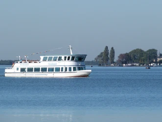
- Do you only want to cycle half the distance? Take advantage of the ferry service during the season and let your bike take you comfortably to the other side of the Steinhuder Meer. You can find information on travel times and prices here.
The Regiobus bicycle bus route 835 also runs around the sea during the summer months and offers bicycle transport by bus. Information on travel times and prices can be found here. By the way: Unfortunately, tandems, recumbent bikes, etc. cannot be taken along. Two-wheelers with moped license plates (e-bikes or other motorized vehicles) are also excluded from transport. Safety guidelines
- Please always stay on the signposted paths, especially in the moorland areas.
Map
- Kartenmaterial zum Rundweg bekommen Sie in den Tourist-Informationen rund um das Steinhuder Meer.
Eine GPX-Datei zum Download für das Smartphone finden Sie weiter unten auf dieser Seite.
Nearby



Download GPX file