- 3:51 h
- 14.89 km
- 134 m
- 138 m
- 101 m
- 168 m
- 67 m
Now NEW: Heath action on the Wilseder Berg heath loop
You fancy exciting puzzles, fun challenges and interesting information on your hike? With our smartphone rally you can experience this free of charge. It's so easy:
Download the free Actionbound app on your mobile
Scan the QR code
Just join in!
You can find more information here.

Best to visit
- suitableDepends on weather
Directions
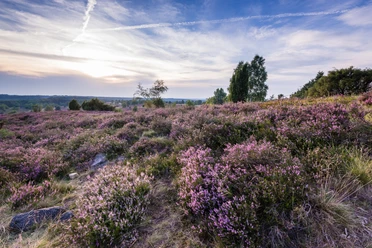
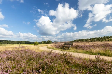
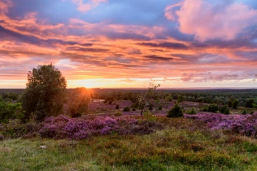
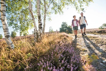
Steingrund, Totengrund, the heathland village of Wilsede, Wilseder Berg, Heidetal: the Wilseder Berg heathland loop is rich in highlights. Alternating heath and forest. Views. Heath landscapes in all variations. One of the most beautiful tours of the Lüneburg Heath. First through Oberhaverbeck. A typical heath village. A few farms. Tall oak trees, which have always been part of the appearance of a heath village. After leaving the village, a first short but steep climb up to the pointed hilltop of the Turmberg. The view sweeps over the surrounding heathland.
Down to the large crossroads. The path leads into the forest to the right. The hiker is surrounded by dense mixed forest. Tall trees. Shadows. Suddenly sunlight. Countless junipers rise up like figures on the opposite slope. The stony ground. The junipers glow in the sun. Casting short and long shadows. The path leads - more along the upper edge - through this fascinating landscape. Benches beckon. If you look closely, you can also see the boulders that gave the valley its name. For some, the most beautiful heath ground.
A small ridge separates the Steingrund from the Totengrund. Before circling the most famous heath valley, it is worth taking a short detour to the viewpoint at the memorial stone for Andreas Thomsen. The professor from Münster acquired the Totengrund in 1906 with the help of the heath pastor Wilhelm Bode from Egestorf. The 6000 gold marks secured the nucleus of today's nature reserve. The view from the vantage point is unique and shows the cauldron-like Totengrund with numerous juniper columns from its most beautiful side.
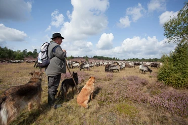
Narrow path at the edge of the Totengrund. Pine roots. Sandy paths. Winding path. Changing views of the Totengrund. Still full of impressions, we pass the sheepfold on the way to Wilsede. A heath village straight out of a picture book. Half-timbered houses, boulder walls, cobblestones. Heidschnuckenkeule or buckwheat cake? Recharge your batteries under mighty oaks.
The Schlangengrund leads up to Wilseder Berg (169m). Highest point of the Lüneburg Heath. Sweeping views over seemingly endless heathland in all directions. The view to the south-west into the Heide valley towards Niederhaverbeck is particularly impressive. The Heideschleife leads through this wide valley on the Heidschnuckenweg to Niederhaverbeck. After the village, take a short detour towards Tütsberg and then through an extremely picturesque heath and juniper landscape back to the hikers' parking lot in Oberhaverbeck.Directions & Parking facilities
- Getting thereStart: Hiking parking lot Niederhaverbeck and hiking parking lot OberhaverbeckParkingParking: Wanderparkplatz Niederhaverbeck, 29646 Niederhaverbeck and Wanderparkplatz Oberhaverbeck, 29646 OberhaverbeckPublic transportationVerkehrsanbindung: Buslinie 156 (Niederhaverbeck - Schneverdingen), Heide-Shuttle vom 15. Juli bis 15. Oktober
Additional information
- Charakteristik: beeindruckender Weg, viel naturnaher, teils sandiger Untergrund, einige
steile Teilstrecke License (master data)
Bispingen Touristik e.V.