Along the circular hiking trail there are several entry points. We recommend the "Deutscher Olymp" as the starting point.
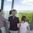
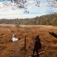
From here, follow the orange direction arrows on white background through the Wingst Forest, past the stone grave and the Königseiche towards the Balksee nature reserve, where a short stop is worthwhile. From the observation tower, you have a great panoramic view and, with a bit of luck, can spot one of the rare white-tailed eagles.
From the Balksee, the path follows the Neuhaus-Bülkauer Canal and leads through the western fringes of the Wingst. It continues on the Wingispfad into the Altkehdinger Forest nature reserve. Along this section in the east of the Wingst, there is a network of numerous hedgerows.
The last part of the trail leads back into the Wingst Forest, past the old Jewish cemetery and the publicly accessible fountain at the waterworks.
The observation tower at Deutscher Olymp marks the end of the 30 km long Wingispfad.
Good to know
Pavements
Best to visit
Directions & Parking facilities
Free parking is available at the Wingst Forest Zoo car park. A limited number of less mobile visitors can also park directly at the tower. The access is also suitable for coaches.
The hiking route is very well accessible by train. The nearest Wingst station is about one kilometer from the route.
The station is served hourly from the directions of Cuxhaven and Hamburg.
Timetable information at: www.bahn.de
Additional information
Literature
More information on hiking trails in the Wingst region at: Wanderbare-Wingst.de
License (master data)
Author´s Tip / Recommendation of the author
Near the Deutscher Olymp observation tower is the Wingst Forest Zoo. The small and lovingly designed zoo hosts a variety of different animal species, focusing on the global wildlife of forests. The zoo also includes a spacious wolf and bear enclosure.
More information at: www.wingstzoo.de
Map
The hiking map "WanderPfade" is available at the Tourist Information Wingst or can be ordered digitally here.
Nearby


