- 6:46 h
- 25.16 km
- 4 m
- Start: Kreuzkuhle, Gnarrenburg
- Destination: Ritterhuder Schleuse
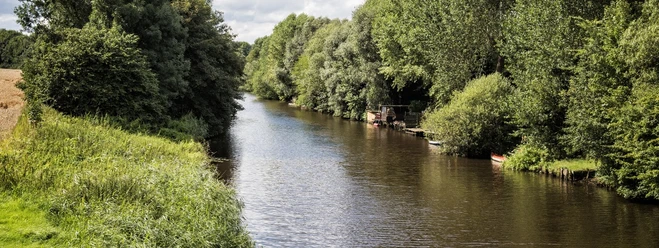
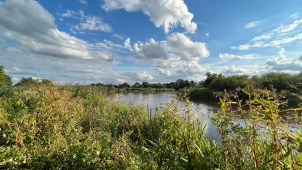
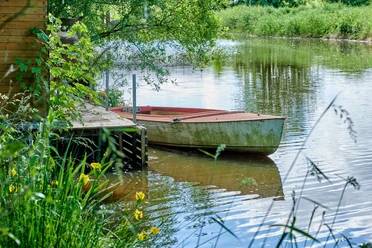
The Hamme leads leisurely through the vast landscape and is also suitable for water sports beginners and families with children. But experienced water sports enthusiasts also appreciate the area in the Hamme lowlands because of the special nature and landscape experiences. The river, which is 48 km long in total, rises northwest of Osterholz-Scharmbeck and flows together with the Wümme in Ritterhude as the Lesum until it flows into the Weser. As there is hardly any current above the Ritterhude lock, the Hamme can be navigated in both directions. There are idyllic rest areas and restaurants for a short break in between. The restaurants close to the banks, Hammehütte, Melchers Hütte and Tietjens Hütte were already resting and customs stations for the moor farmers and their peat barges in the 18th century.
Navigability
The Hamme can be navigated easily in both directions due to the lack of current. However, please note the night navigation ban and the winter navigation ban.
Navigability
The Hamme can be navigated easily in both directions due to the lack of current. However, please note the night navigation ban and the winter navigation ban.
- Night navigation ban from 11.00 pm to 6.00 am
- Winter navigation ban from 1. 11. to 31. 3. between Neu Helgoland and Melchers Hütte


Best to visit
- suitableDepends on weather
Directions & Parking facilities
- Getting thereViehspecken: Gasthaus Dierks, Viehspecken 1, 27729 Vollersode
Teufelsmoorschleuse: Campingplatz Meyer, Schleusenweg 1, 27711 Osterholz-Scharmbeck
Hammehafen Worpswede: Hammeweg 10, 27726 Worpswede
Ritterhuder Schleuse: Dammstraße 14, 27721 RitterhudeParkingParking is available at most of the landing stages. Please park your car(s) and trailer(s) only in public parking areas and not on private property, field paths, meadows or restaurant parking lots.Public transportationBahnhof Ritterhude
Bahnhof Osterholz-Scharmbeck Contact person
Touristikagentur Teufelsmoor-Worpsweder-Unterweser e.V.
Osterholzer Str. 2327711 Osterholz-ScharmbeckLicense (master data)
Touristikagentur Teufelsmoor-Worpswede-Unterweser e.V.

Author´s Tip / Recommendation of the author
- The Ritterhude Lock serves as the gateway to the Teufelsmoor. From here, we recommend a tour through Osterholz-Schamrbeck to the artists’ village of Worpswede. End your tour in Neu Helgoland and enjoy a fantastic sunset by the water with a delicious meal and a Moorbier.
There are several campgrounds right on the Hamme River, where you can usually find a spot for your boat and tent. Safety guidelines
In many places in the "Hammeniederung" nature reserve, fens and wet meadows are home to numerous plant species as well as habitats or resting places for many water and meadow birds. It is forbidden to drive into reed beds, riparian copses and other overgrown shoreline areas as well as water areas with reed beds and floating leaf zones, e.g. pond and water lilies. These are not only home to endangered plant species, but also breeding and rearing grounds for many animal species. Please observe the rules for nature-friendly water hiking, the rules for navigating the Hamme and the water hiking signs.
Map
- Das Kulturland Teufelsmoor ist mit den Flüssen Hamme und Wümme ein attraktives Revier für Wasserwanderer. Die wichtigsten Infos bietet die kostenlose Wasserwanderkarte „Wasserwandern im Teufelsmoor“. Darin enthalten sind u.a. eine große Übersichtskarte, detaillierte Informationen über das Wasserwegenetz und die Infrastruktur entlang der Flüsse. Auf Regeln zum naturverträglichen Wasserwandern wird in der Karte ebenfalls hingewiesen, damit die sensible Natur entlang der Flüsse den Besuchern des Teufelsmoores auch nachhaltig Freude bereitet.
Die Wasserwanderkarte dient Paddlern zur Orientierung. Die darin aufgeführten Gastronomiebetriebe sind, wie die vier Kanuverleihstellen entlang von Hamme und Wümme, leicht auffindbar dargestellt. Ebenso sind Anlegestellen, Rastplätze, Schleusen und Übernachtungsmöglichkeiten eingezeichnet.
Die Wasserwanderkarte ist kostenfrei bei den Tourist-Informationen und Kanuverleihstellen in der Region sowie als Download im Internet unter www.wasserwandern-teufelsmoor.de erhältlich