Wild Vogler (Go 1)

- 3:00 h
- 8.32 km
- 281 m
- 281 m
- 219 m
- 437 m
- 218 m
- Start: Sports field in Holenberg
- Destination: Sports field in Holenberg
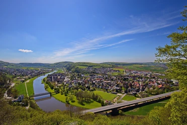
From the sports field in Holenberg, you hike directly into the forest. For about 1,800 m, you move slightly uphill and downhill, mostly on wide gravel paths at the lower slopes of the Vogler. After crossing a bridge, turn left into the Hüttebachtal valley. You walk along natural meadows until you come across a path that leads from the valley on the left to the right and slightly uphill to the forest. Here begins a good 2 km climb to the Ebersnacken, initially continuing on a gravel path, then on forest trails. Shortly before the summit, you encounter the Weserbergland Trail, which your hike now runs parallel to. After about 200 m, you reach the highest elevation in Vogler, the 460 m high Ebersnacken. From the 26 m high Ebersnacken Tower, you have a great panoramic view. The hiking tour continues downhill. You walk for about 600 m on the Vogler ridge trail until you turn right and descend on forest paths to Holenberg. Just before reaching the village, you have a great view into the distance towards Holzberg. In Holenberg, turn right. On meadow paths and past a picnic area, you reach your starting point at the sports field in Holenberg.
Please note that due to repair work, the Ebersnacken Tower is currently closed and may not be entered.


Good to know
Pavements
- Asphalt (10%)Gravel (28%)Trail (60%)Path (2%)
Best to visit
- suitableDepends on weather
Directions
- The hiking tour starts at the sports field in Holenberg, where you can also park. Initially, you walk slightly uphill on an asphalt road. Soon, a path branches off to the right, but you continue straight ahead. Further along, the asphalt road turns into a gravel path and leads into the forest. After about 300 m in the forest, you reach a fork in the path.
In front of you lies the 302 m high Weinberg, which is located in the middle of a nature reserve. Historically, the Weinberg belonged to the Amelungsborn monastery. It is characterized by calcareous dry grasslands on shallow shell limestone at the slopes and calcareous beech forest on the summit. On the grasslands, which are grazed by sheep for maintenance, numerous gentians and orchids grow; orchids can also be found in the beech forest. First, keep to the right to continue a few meters straight ahead or slightly left.
Follow the still-gravelled path for about 1.5 km straight ahead. You will then reach a bridge, behind which you immediately turn left into the dreamy Hüttebachtal valley. You have to cross the stream twice at small fords. You hike along natural meadows until you come across a path that leads from the valley on the left to the right and slightly uphill to the forest. Now turn right.
About 500 m further, you come to a crossroads; here, climb up to the right. Shortly after the turn, admire an oak tree at least 300 years old. After a few meters you leave the forest path; on the left, use a short concrete driveway that then transitions into a forest trail. Here begins the steep, almost 1.5 km-long ascent to the Ebersnacken. In the last section, you pass through a light beech forest that offers a clear view of the Ebersnacken Tower.
Shortly before the summit, you encounter the Weserbergland Trail, which the quality tour now runs parallel to. After about 200 m, you reach the highest peak in Vogler, the 460 m high Ebersnacken. A shelter and the 26 m high Ebersnacken Tower invite you to take an extended break with food from your rucksack and to enjoy an excellent panoramic view.
Then the path continues downhill. You hike for about 600 m on the Vogler ridge trail, then turn right onto a forest path that initially runs flat along the slope and then ascends crossing a ridge. Your path continues together with the Weserbergland Trail, relatively steep downhill into the Holenberger forest valley. There, you come across a well-developed forest service road, which you cross. Keep going downhill.
After about 800 m, after you have walked a wide curve to the right, you exit the forest. At this point, you have a great view of the village of Holenberg and the Holzberg further away in the distance. You can take a short break on a bench before continuing downhill towards the village.
After about 250 m, you reach a crossroads in Holenberg. Turn right here. About 100 m further, you leave the village; the asphalt road turns into a meadow path. You walk parallel to the slope, slightly downhill past a monument. In a sharp left curve, you pass a larger picnic area on the right-hand side. After another 100 m downhill, turn left onto the asphalt road. After a few meters, you reach your starting point at the sports field in Holenberg.
Equipment
- Sturdy footwear, possibly self-catering from backpack
Directions & Parking facilities
- Getting there
From Bodenwerder via the L 580, turn right into Försterbrink at the entrance to Golmbach. From Holzminden via the B 64 towards Hannover, onto the L 580 after Negenborn. From Stadtoldendorf via K 71 and then L 580.
ParkingHiking car park Holenberg. At the sports field in Holenberg.
Public transportationTake the train to Holzminden or Stadtoldendorf, then continue by bus line 531 towards Stadtoldendorf or Holzminden.
Additional information
- Solling-Vogler Region in Weserbergland e. V.
Tourist Center
Lindenstr. 8
37603 Holzminden/Neuhaus
Phone 05536 960970
info@solling-vogler-region.de
www.solling-vogler-region.de License (master data)
Solling-Vogler-Region im Weserbergland e.V.

Author´s Tip / Recommendation of the author
- From the 26-meter-high Ebersnacken Tower, you can enjoy a wonderful panoramic view.
Safety guidelines
- Please note that due to repair work, the Ebersnacken Tower is currently closed and may not be entered.
Nearby




Download GPX file