Weserbergland-Weg, 7th stage: Stadtoldendorf to Bodenwerder

18.77 km long
Difficulty: easy
Condition: very easy
Great panorama
Walking / hiking
  • 5:24 h
  • 18.77 km
  • 362 m
  • 500 m
  • 71 m
  • 437 m
  • 366 m
  • Start: Stadtoldendorf
  • Destination: Bodenwerder
The seventh stage leads 19 kilometers from Stadtoldendorf to the Münchhausen town of Bodenwerder.

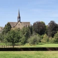
The seventh stage starts in the half-timbered town of Stadtoldendorf, which offers exciting active experiences alongside peace and relaxation. The Weserbergland-Weg leads from Stadtoldendorf to Amelungsborn Monastery. Not far from the village of Negenborn lies this accessible monastery grounds with its eventful history and monastery garden known for its old medicinal herbs. Heading north, it goes on to Holenberg, right through a dreamy landscape also known as the 'Tuscany of the North.' This is followed by an ascent to the 26 m high Ebersnacken Tower, from which you have a unique view over valleys and hill ranges of the Weserbergland. Along lonely forest and nature trails, the Weserbergland-Weg leads over the Vogler ridge to the Königszinne lookout high above the stage destination Bodenwerder. From the Königszinne, the path then goes down to the town right on the Weser, made world-famous by Baron von Münchhausen.

Good to know

Pavements

Street
Asphalt
Gravel
Trail
Path

Best to visit

suitable
Depends on weather

Directions

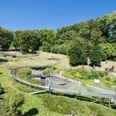
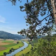
The stage start is the half-timbered town of Stadtoldendorf, which offers exciting active experiences alongside peace and relaxation. For example, you can soar high while hang gliding on the nearby Ith ridge. Pure adrenaline is also promised by Mammut Adventure Park, a 60-hectare off-road area in hilly terrain, which can be explored with a rental off-road vehicle. After hiking towards the outskirts of Stadtoldendorf, turn left opposite the Mühlenanger hiking parking lot onto Rosenbuschweg to the next stop, Amelungsborn Monastery. This accessible Cistercian monastery is near Negenborn and fascinates with its eventful history. Especially worth seeing is the monastery garden, where old medicinal herbs still grow today. Continuing north towards Holenberg, the Weserbergland-Weg leads through a dreamy landscape also known as the 'Tuscany of the North.' After that comes an ascent to the 26-meter-high Ebersnacken Tower, from which you can enjoy a unique 360° panoramic view of the idyllic valleys of the Weserbergland. Along lonely forest and nature trails, the route continues through the Vogler ridge to the Königszinne lookout, a castle-like monument built in 1863 in honor of the last King of Hanover. From here, you can already glimpse your stage destination Bodenwerder, which lies nearby. Bodenwerder, also known as the home of Baron von Münchhausen, offers a beautiful finishing point for your hiking tour on the Weserbergland-Weg with its direct location on the Weser.

Equipment

Sturdy footwear is assumed. In summer, you should carry enough water.

Directions & Parking facilities

Information on different travel options can be found here.

Further information is available from local tourist information offices and on our interactive map.

Information on public transportation on the Weserbergland-Weg can be found here.

Additional information

Literature

Service booklet: The Weserbergland-Weg, with map excerpts, route description as well as hotel and gastronomy tips. Available free of charge at http://www.weserberglandweg.de

License (master data)

Weserbergland Tourismus e.V.
License: Attribution

Author´s Tip / Recommendation of the author

Experience fun and adventure at Mammut Adventure Park or enjoy the view of Bodenwerder from the Königszinne lookout.

Safety guidelines

In some places, good sure-footedness is required. Divide the route into stages according to your strength. When wet, some parts can be slippery.

Map

Map 'Weserbergland-Weg', current route guidance, access routes and other forest and hiking trails, dimensions: 11 x 18.5 cm, paperback (TB), German, scale: 1:50000 Publisher: Kompass ISBN 978-3-85026-861-5

Interactive map 'The Weserbergland Navigator', digital route guidance, elevation profiles, and GPS tracks. Here you can access the Weserbergland Navigator.

Nearby

Contact

Weserbergland-Weg, 7th stage: Stadtoldendorf to Bodenwerder
37627 Stadtoldendorf