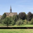
From Lüntorf, the Weserbergland Route continues over Amelgatzen towards Hämelschenburg Castle, down into the Emmer valley. Hämelschenburg is definitely worth a break. Wide gardens, a church, and the magnificent Weser Renaissance castle invite you to linger. Since 1437, the well-preserved manor has been owned by the von Klencke family and is still sustainably managed today. From Hämelschenburg Castle, it is only a short distance to Emmerthal as the stage destination. Along the forest edge, the Weserbergland Route here leads on natural paths. In Emmerthal, the Emmer flows into the Weser—a paradise not only for hikers but also for water sports enthusiasts: pause your hike here for a canoe trip!
Good to know
Pavements
Best to visit
Directions
Lüntorf, located at the foot of the Ottensteiner Plateau, invites you to pure relaxation. Away from stress and hectic, you can forget your daily worries here. The highlight is the annual rapeseed blossom festival in spring on the Ottensteiner Plateau, which also fills the village of Lüntorf with plenty of life.
From Lüntorf, the Weserbergland Route leads you over Amelgatzen towards Hämelschenburg. The magnificent Weser Renaissance castle lies in the Emmer valley and is considered one of the most beautiful Renaissance complexes in Germany with its gardens, utility buildings, and the church. The fully preserved manor has been owned by the von Klencke family since 1437 and is still sustainably managed today. The valuable art collection includes paintings, furniture, porcelain, glasses, and weapons from the 5th century. A short break after your hike is worthwhile at the idyllic castle café and beer garden. From here, you have a magical view of the entire complex. From Hämelschenburg Castle, it is only a short distance to Emmerthal, the destination of this stage. The widely visible green-blue XW markings guide you along wooded ridges on beautiful natural paths. Emmerthal is shaped by the two rivers Emmer and Weser. It is therefore not surprising that water sports enthusiasts such as rowers and canoeists meet here.
Equipment
Sturdy footwear is assumed. In summer, you should bring enough water.
Directions & Parking facilities
Information on different travel options can be found here.
Further information is available from the local tourist offices and on our interactive map .
Information about public transport on the Weserbergland Route can be found here.
Additional information
Literature
Service booklet: The Weserbergland Route, with map excerpts, route descriptions, as well as hotel and restaurant tips. Available free of charge at http://www.weserberglandweg.de
License (master data)
Author´s Tip / Recommendation of the author
Visit the magnificent Weser Renaissance castle Hämelschenburg or enjoy a well-deserved break at the idyllic castle café.
Safety guidelines
Good surefootedness is required in some places. Divide the route into stages according to your strength. It can be slippery in some spots when wet.
Map
Map "Weserbergland Route", current trail guidance, access paths and other forest and hiking trails, dimensions: 11 x 18.5 cm, paperback (TB), German, scale: 1:50000 Publisher: Kompass ISBN 978-3-85026-861-5
Interactive map "The Weserbergland Navigator", digital route guidance, elevation profiles, and GPS tracks. Here is the Weserbergland Navigator.
Nearby


