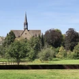
On the eleventh stage, you leave the Pied Piper town of Hameln behind. The old town of Hameln with its historic narrow streets invites discovery before the hiker sets off towards Rohdental. Over 27 km lies a long but beautiful stage ahead for hiking enthusiasts. Through the Süntel, it continues north, where on the "Hohe Egge" you reach the Süntel tower with its attached inn. Shortly thereafter, the Hohenstein cliffs follow on the Weser Uplands Trail; a truly legendary viewpoint with the best views invites you to pause directly on the rocks. From the cliffs, the path leads further downhill to Baxmannbaude. This hiking hut is staffed on weekends during the season and offers a cozy break. It continues past Lower Saxony's only natural waterfall to the Schillat Cave and over the Moosköpfe to Rohdental.
Stage 11: Due to a broken bridge near Heisenküche, a detour on stage 11 is signposted.
Good to know
Best to visit
Directions
Hameln is world-famous as the Pied Piper town. The mythical legend comes alive every year during the summer months with the famous Pied Piper open-air play and the Pied Piper musical RATS. The old town of Hameln with its narrow streets and the Weser promenade will also impress you.
From Hameln, you hike through the Schweineberg nature reserve, where in March one of the largest populations of spring snowflakes blooms extensively. Then it continues through the Süntel towards the north. On its ridge, the Hohe Egge, stands the stone Süntel tower. The attached inn invites you to relax here. The next stop on your hiking tour is the massive Hohenstein cliffs, a mysterious, rocky reef from a past era. From the Devil's Pulpit, there are wonderful views into the distance of the Weser Uplands. After this natural spectacle, descend to the Baxmannbaude forest tavern, which spoils many hikers with cool drinks on weekends.
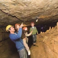
Through beautiful forest areas with endangered yews, the path then leads you to the famous Moosköpfe, a viewpoint overlooking the Hohenstein massif. Not far from here is the natour.NAH.zentrum Schillat Cave, newly opened in 2014. This hiking information center offers you unusual insights into the local flora and fauna through a 3D show. You will also receive numerous hiking tips. Directly connected to the center is the Schillat Cave, Germany's northernmost dripstone cave. In a glass-walled elevator, you descend 45 meters into the depths of millions of years of earth history. On the way to your stage destination Rohdental, you will then find a refreshment of a different kind, the Langenfeld waterfall. The waterfall is the only natural waterfall in Lower Saxony, and the cool water plunges 15 meters down before your eyes.
Equipment
Sturdy footwear is required. In summer, you should bring enough water.
Directions & Parking facilities
Information on various travel options can be found here.
Further information is available from local tourist information offices and in our interactive map.
Information about public transport on the Weser Uplands Trail can be found here.
Additional information
Literature
Service booklet: The Weser Uplands Trail, with map excerpts, route descriptions as well as hotel and dining tips. Available free of charge at http://www.weserberglandweg.de
License (master data)
Weserbergland Tourismus e.V.
Author´s Tip / Recommendation of the author
Take a break in the rustic inn at the Süntel tower or immerse yourself in the underworld of the Schillat Cave.
Safety guidelines
Good sure-footedness is required in some places. Divide the path into stages according to your strength. It can be slippery in some places when wet.
Map
Map "Weserbergland-Weg", current route guidance, access routes and other forest and hiking trails, size: 11 x 18.5 cm, paperback (TB), German, scale: 1:50000 Publisher: Kompass ISBN 978-3-85026-861-5
Interactive map "Der Weserbergland-Navigator", digital route guidance, elevation profiles and GPS tracks. Here you can access the Weserbergland Navigator.
Nearby


