Good to know
Pavements
Best to visit
Directions
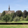
We start our hike at the Mühlenanger car park, walk about 50 meters along the road, cross it at the pedestrian light, turn left onto the gravel Rosenbusch path passing the last houses and reach open fields. On the left side is a field barn, behind the barn the so-called "Kummerberg", a spoil heap made of sandstone. If we turn towards the town, we see the landmark of Stadtoldendorf, the Försterberg tower. To the left is the Kellberg with tower and a transmitter mast, to the right in the background is the over 400 m high Holzberg. After about 1 km we reach the edge of the forest. There is a memorial stone commemorating a plane crash in 1972. We go down the path through the forest, cross the mostly dry Fahrenbach stream, then turn right and after about 150 m leave the forest to walk about 500 m along the field with a wonderful view of Odfeld and Vogler as well as the village of Holenberg and re-enter the forest. There we walk about 700 m on natural paths and trails past a lone oak about 250-300 years old standing in the mixed forest. Then we come to a grass path. There we turn right and after 50 m turn left again, slightly uphill onto the path that runs along the monastery wall. Via a steel staircase we come over the monastery wall onto the monastery grounds (with toilet). After visiting the monastery church (recommended), the herb garden and a short break, we go back down the few steps of the steel staircase and after about 20 m turn right onto the path, which goes about 200 m steeply downhill toward the Grundmühl pond. Then we walk about 1 km through the romantic Hoop Valley, past the barbecue area "Shilo Ranch", located in an old sandstone quarry with a shelter. Then we turn right to turn right again after about 20 m. We cross the bridge over the Forstbach, walk on the road on the right about 100 m behind the guardrails, cross the road there and walk about 300 m up the "Rosstrappe". At the top we are rewarded with a panoramic view (village Arholzen, Solling, Ottenstein plateau, Rühler Switzerland, Burgberg). There is also a rest hut, information boards, a bee stand, an insect hotel, and numerous oaks around 250-300 years old, of which over 20 are designated as natural monuments. After a short rest we go left about 300 m along the so-called "Oak Avenue", then come onto an asphalt path that leads us along the railway. After about 450 m we turn left and go down the path to the road. We cross it and walk behind the wastewater treatment plant along a large historic sandstone dry wall (created by the many sandstone quarries in the Hoop Valley last century). Behind the wall we turn right and take the path uphill, at the top we pass briefly through a forest. Upon leaving the forest, the view goes to Homburg and the gypsum quarries. We then walk left about 450 m along the path by an old sandstone quarry and come back to the memorial stone at Rosenbusch. From there we go right towards town and soon see the landmark of Stadtoldendorf, the Försterberg tower again. Arriving back at the car park, there are some fitness machines. Those who still have energy can do a few exercises here.
Equipment
Sturdy footwear, self-catering from your backpack, no dining options.
Directions & Parking facilities
From Holzminden on the B 64 towards Eschershausen. After about 5 km turn right onto L 583 and follow it to Stadtoldendorf. From Einbeck via L 546 via Lüthorst and Wangelstedt, then turn left onto L 583 and follow it to Stadtoldendorf.
Stadtoldendorf Mühlenanger
Arrival by train to Stadtoldendorf. From there take bus 530 towards: Brunnengasse, Eschershausen (Ith) to the Mühlenanger stop.
Additional information
Solling-Vogler-Region in Weserbergland e. V.
Tourism Center
Lindenstraße 8
37603 Holzminden/Neuhaus
Tel.: 05536 960970
info@solling-vogler-region.de
www.solling-vogler-region.de
License (master data)
Author´s Tip / Recommendation of the author
A visit to the Amelungsborn monastery church and the herb garden should definitely not be missed.
Nearby


