Bach-Route
- 2:52 h
- 45.07 km
- 56 m
- 54 m
- 22 m
- 63 m
- 41 m
- Start: Visselhövede Town Hall, Marktplatz 2, 37374 Visselhövede
- Destination: Visselhövede Town Hall, Marktplatz 2, 37374 Visselhövede
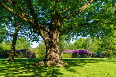
The stream route takes you through the southern countryside of the district of Rotenburg (Wümme) with its forests, meadows and fields criss-crossed by numerous streams. During your tour, you will pass through idyllic villages and gems such as the Federlohmühlen watermill and you will reach the Great and White Moor with the two Bullensee lakes. You can even swim in the large Bullensee lake.
Good to know
Best to visit
suitable
Depends on weather
Directions
You first cycle from the town hall in Visselhövede to Buchholz, a small village with an attractive townscape, in the direction of Hütthof. Away from the hustle and bustle, the route crosses the Visselbach bridge towards Wittorf and continues along an old railroad line to Bothel. Idyllically situated between the small rivers Rodau, Wiedau and Vissel, the village invites you to take a break.
The route continues via Hastedt (crossing the B 440) past Hartmannshof to the Large and White Moor recreation and nature reserve. All year round, there are fourenchanted hiking trails through moor, forest and heath. One of them is the NORDPFAD Dör' t Moor. In the moor experience zone, the moor habitat can also be explored with all the senses at many stations. Information boards and themed pavilions point out special features along the way, explain interesting facts about the nature reserve and invite you to linger. The two associated lakes, the Large and the Little Bullensee, were formed towards the end of the last ice age as a relic of a glacier in the Wümmen lowlands. In summer, the large Bullensee offers the best conditions for a "cooling off" swim. From Bullensee, you can also take a detour to the district town of Rotenburg (Wümme) on signposted cycle paths.
Without a detour, the path leads from Bullensee in the direction of Kirchwalsede to the junction to Federlohmühlen. Here you will find a beautiful Lower Saxon farmstead with a watermill in the middle of an oak grove.
Above the farmstead, the trail continues to Riekenbostel and from there via Lüdingen to Hainhorst and Wittorf. The St. Nikolaus Chapel in Wittorf was founded in 1605 and is one of the few half-timbered chapels that dates back to before the Thirty Years' War.
On the last stage, head towards Jeddingen until you reach the turn-off to Nindorf. With a bit of luck, you may see a large herd of fallow deer that live here. Enjoy the partly historic townscape with the old Lower Saxony farms. From here it is not far back to Visselhövede through beautiful fields.
The route leads through the following places:
Visselhövede - Buchholz- Hütthof - Wittorf - Bothel - Hastedt - Bullensee - Kirchwalsede - Federlohmühlen - Riekenbostel - Lüdingen - Hainhorst - Wittorf - Nindorf - Visselhövede
Route markings
Folgen Sie dem weißen Logoschild mit der blauen Aufschrift Bach-Route und der darauf abgebildeten Welle.
Directions & Parking facilities
Visselhövede is located in the very south of the district of Rotenburg (Wümme). You can reach the small town from Bremen via the A 27 in the direction of Hanover (exit Verden Süd) and via the small country road that leads via Kirchlinteln and Jeddingen to Visselhövede.
From Rotenburg (Wümme), simply follow the B 440 to Visselhövede.
From Hamburg, take the A 7 towards Hanover (Bispingen exit) and follow the B 3 via Neuenkirchen to Visselhövede.
From Hanover, follow the A 7 (Walsrode-West exit) and the B 209 towards Walsrode. From there, take the country road in the direction of Visselhövede
Various free parking options are available at Feldstraße 4-6 in a discount store parking lot, not far from the town hall.
Mit der Bahn erreichen Sie Visselhövede am besten mit dem Heidesprinter „erixx“, der Bremen mit Uelzen verbindet. Nähere Infos siehe www.erixx.de
Daneben gibt es zahlreiche Busverbindungen, die nach Visselhövede führen, jedoch ohne Mitnahmemöglichkeit von Fahrrädern (Bahnhof Visselhövede). Weitere Informationen zu den Busverbindungen finden Sie hier: www.vbn.de
Daneben gibt es zahlreiche Busverbindungen, die nach Visselhövede führen, jedoch ohne Mitnahmemöglichkeit von Fahrrädern (Bahnhof Visselhövede). Weitere Informationen zu den Busverbindungen finden Sie hier: www.vbn.de
Additional information
Der Landkreis Rotenburg (Wümme) verfügt über ein ca. 1.800 km langes und ausgeschildertes Radwegenetz. Sternradfahrer können von einem Ort aus gleich mehrere Routen ansteuern. Für mehrtägige Touren stehen zudem acht Radfernwege zur Verfügung.
Sollten Sie Unstimmigkeiten oder Fehler in der Beschilderung oder in der Ausweisung der Routen vorfinden, sehen Sie es uns bitte nach. Wir sind am Thema dran! Zurzeit findet eine kreisweite Qualitätsüberprüfung des Radwegenetzes und der Radrouten statt. Die Ergebnisse werden uns weiterhelfen, sämtliche Schwachstellen (z. B. fehlende Wegweisung, verdrehte Schilder, unpassierbare Abschnitte) zu ermitteln und zu beheben.
Sie benutzen zur Tourenplanung und unterwegs die App KOMOOT? Dann dürfte es Sie freuen, dass sämtliche unserer Radtouren auf dem Online-Portal KOMOOT zu finden sind. Sie können sich den GPX-Track zur Tour auch hier herunterladen (siehe grünes Feld rechts, unterhalb der Karte) und diesen direkt auf dem Computer, Laptop, Tablet oder Smartphone speichern. Zur weiteren Planung und zum Routing vor Ort gibt es diverse kostenfreie Apps und Programme, mit deren Hilfe man sich die heruntergeladenen GPX-Tracks (z. B. auf einem Smartphone) anzeigen lassen kann.
Contact person
Touristikverband Landkreis Rotenburg (Wümme) e.V.
- Ihr Ansprechpartner für die Region
Harburger Straße 59
27356 Rotenburg (Wümme)
License (master data)
Touristikverband Landkreis Rotenburg (Wümme)

Author´s Tip / Recommendation of the author
Sights and points of interest along the route:
- Visselhövede with St. Johanniskirche, Heimathaus, Bürgerpark Visselseen and indoor swimming pool
- Buchholz, attractive village
- Visselbach and Rodau
- Bothel with windmill and church worth seeing
- Hartmannshof with farm café and NABU hands-on and adventure garden MeGa
- Nature reserve Großes Moor and Weißes Moor with moor experience zone and numerous hiking trails, such as the NORDPFAD Dör' t Moor
- Large Bullensee lake with bathing beach and children's playground
- Federlohmühlen water mill on the Federlühmühlenbach stream
- Villages of Riekenbostel, Lüdigen, Wittorf and Nindorf
Map
Kompass-Radkarte Radregion Landkreis Rotenburg (Wümme); Maßstab 1:60.000; Kompass Verlag; ISBN 978-3-85026-549-2; Preis 7,99 €; erhältlich über den Buchhandel oder über www.kompass.de
ADFC-Regionalkarte Radlerparadies Landkreis Rotenburg (Wümme) zwischen Hamburg und Bremen; Maßstab 1:75.000; BVA-Verlag; ISBN 978-3-87073-673-6; Preis 8,95 €, erhältlich über den Buchhandel oder über www.fahrrad-buecher-karten.de
ADFC-Regionalkarte Radlerparadies Landkreis Rotenburg (Wümme) zwischen Hamburg und Bremen; Maßstab 1:75.000; BVA-Verlag; ISBN 978-3-87073-673-6; Preis 8,95 €, erhältlich über den Buchhandel oder über www.fahrrad-buecher-karten.de
Social Media
Nearby