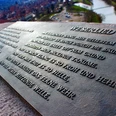
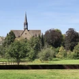
The Weserbergland-Weg (XW) starts in Hann. Münden directly at the Weserstein, where "Werra and Fulda kiss" and continue as the Weser. From here, the hiking route leads you up to the Tillyschanze and into the Reinhardswald. Here you hike through a 200 km² forest area of Northern Hesse, one of the least densely populated areas in Germany. Accordingly, the XW leads you through expansive nature. The path runs through wide wooded pastures. The destination of the first roughly 14 km stage is Veckerhagen. This district of Reinhardshagen is striking due to its beautiful half-timbered architecture; many houses date from the 17th century. The landmark of Veckerhagen is the castle, also known as "Habich's Castle."
Please note: The suspension bridge at Weserstein in Hann. Münden had to be closed. To get onto the Weserbergland-Weg, cross the Pionierbrücke and from there take a path that leads into the XW. (As marked on the map.)
Good to know
Pavements
Best to visit
Directions
Welcome to the Weserbergland-Weg (XW). The path leads you along 225 kilometers from the source of the Weser to its mouth in the North German lowlands, crossing the entire Weserbergland holiday region. The starting point of the hiking trail is the famous Weserstein in the half-timbered town of Hann. Münden, where "Werra and Fulda kiss." Hann. Münden is known for its impressive half-timbered buildings and small, charming streets. Following the river's bends, the Weserbergland-Weg leads on the left side of the Weser into the Reinhardswald, a forest area of over 200 km² in Northern Hesse. The Reinhardswald is one of the least densely populated areas in Germany with extensive wooded pastures. The first highlight on this stage is the Tillyschanze, a 25-meter-high observation tower with an attached museum. Just a few meters from the Tillyschanze tower, a short break is recommended at the forest inn with its idyllic beer garden. The Weserbergland-Weg winds along mostly natural paths past gnarly oaks and beeches. As you head north, you will often be rewarded with fantastic views. The destination of the first stage of the Weserbergland-Weg is Veckerhagen, a district of Reinhardshagen. Numerous half-timbered houses from different eras, mainly from the 17th century, adorn this place. A worthwhile excursion destination is the Veckerhagen Castle, also called Habich's Castle.
Equipment
Sturdy footwear is required. In summer, be sure to bring enough water.
Directions & Parking facilities
Information about different travel options can be found here.
Further information is available from the local tourist offices and on our interactive map.
Information about public transportation on the Weserbergland-Weg can be found here.
Additional information
Literature
Service booklet: The Weserbergland-Weg, with map excerpts, route descriptions, and hotel and restaurant tips. Available free of charge at http://www.weserberglandweg.de
License (master data)
Weserbergland Tourismus e.V.
Author´s Tip / Recommendation of the author
Take a break with a refreshing drink in the beer garden at the Tillyschanze tower or visit the impressive Veckerhagen Castle at the end of the stage.
Safety guidelines
Good surefootedness is required in some places. Divide the path into stages according to your strength. It can be slippery in some places when wet.
Map
Map "Weserbergland-Weg", current route guidance, access paths, and additional forest and hiking trails, dimensions: 11 x 18.5 cm, paperback (TB), German, scale: 1:50000 Publisher: Kompass ISBN 978-3-85026-861-5
Interactive map "The Weserbergland Navigator," digital route guidance, elevation profiles, and GPS tracks. Here you can access the Weserbergland Navigator.
Nearby

