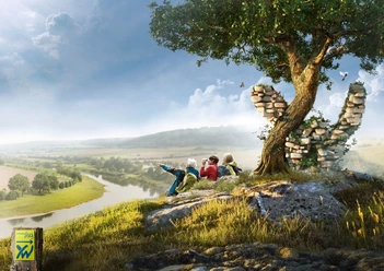
Weserbergland-Weg, 12th stage: Rohdental to Rinteln

- 5:47 h
- 15.89 km
- 559 m
- 515 m
- 99 m
- 342 m
- 243 m
- Start: Rohdental
- Destination: Rinteln
From Rohdental, the now well-known green-blue XW signposts lead to the Paschenburg, a representative stone house built in 1842 in the middle of the forest. You can expect a magnificent view over the wide Weserbergland. Below the Paschenburg is a rock crevice that harbors the mystical: According to legend, small goblins with long beards and pointed caps live in the caves and crevices below Paschenburg. Who knows, maybe you will even encounter such a goblin? From Paschenburg, a short detour down to Schaumburg Castle is worthwhile. You will be rewarded here with an amazing view over the Weser Valley, and the attached catering offers itself for a lunch break. After leaving Schaumburg behind, the Weserbergland-Weg follows the ridge of the Weser Mountains. Over the Luhden Cliff Tower, you can hike down into the beautiful old town of Rinteln, directly on the Weser.


Good to know
Best to visit
- suitableDepends on weather
Directions
From Rohdental, follow the green-blue XW markers of the Weserbergland-Weg to Paschenburg, a representative stone house built in 1842 by forest ranger Carl Kayser. Today, Paschenburg with its attached restaurant is a popular excursion destination in the northern Weserbergland. Not only the magnificent view but also the rock crevice below Paschenburg promises a special experience. According to legend, the caves below the castle were once inhabited long ago by small goblins with large beards and pointed caps. Who knows, maybe you will discover one of them even today...
From Paschenburg, a detour to Schaumburg Castle is worthwhile. Old walls and towers, mysterious legends and inscription stones, a dark castle dungeon, and a wonderful view from the top of the 30-meter-high Georg Tower take you to another, long-forgotten world. After a short break, it goes back to the rugged forests of the Weserbergland Nature Park. The next stop is the Springsteine, a protected natural monument. The rock formations are up to about 4 meters in size. In the rugged rock, cracks and cave entrances open between the rock noses. The Springsteine consist of coral oolite, like the Hohenstein and the Ith. The name "Springsteine" probably comes from a time when this ridge was less densely forested. Back then, from Schaumburg and Deckbergen, it looked as if the cliffs on the mountain were protruding.
Over the Luhden Cliff Tower, the last stage descends to Rinteln. The former university and fortress town lies directly on the Weser and impresses with its colorful historic old town center.
Equipment
We expect sturdy footwear. In summer, be sure to bring enough water.
Directions & Parking facilities
- Getting there
Information about different travel options can be found here.
ParkingFurther information is available from local tourist information offices and in our interactive map.
Public transportationInformation on public transport on the Weserbergland-Weg can be found here.
Additional information
Literature
Service booklet: The Weserbergland-Weg, with map excerpts, route descriptions as well as hotel and restaurant tips. Available free of charge at http://www.weserberglandweg.de
License (master data)
Weserbergland Tourismus e.V.

Author´s Tip / Recommendation of the author
Experience the legendary Paschenburg or enjoy the view from the 30-meter-high Georg Tower of Schaumburg Castle.
Safety guidelines
At some points, good surefootedness is required. Divide the route into stages according to your strength. It can be slippery at some points when wet.
Map
Map "Weserbergland-Weg", current route guidance, access routes and other forest and hiking trails, dimensions: 11 x 18.5 cm, paperback (TB), German, scale: 1:50000 Publisher: Kompass ISBN 978-3-85026-861-5
Interactive map "The Weserbergland Navigator", digital route guidance, elevation profiles and GPS tracks. Here is the Weserbergland Navigator.