- 4:45 h
- 13.60 km
- 9 m
- 11 m
- 24 m
- 39 m
- 15 m
- Start: 27383 Scheeßel, local history museum, Am Meyerhof (starting point 1)
- Destination: 27383 Scheeßel, local history museum, Am Meyerhof (starting point 1)
The local history museum, historic farmsteads, the LandPark, and the sensory garden are the cultural highlights—the Heide, the Wümme River, and the Wümme meadows provide the natural backdrop for this particularly diverse NORDPFAD.
Pavements
- Asphalt (100%)
Best to visit
- suitableDepends on weather
Directions
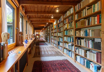
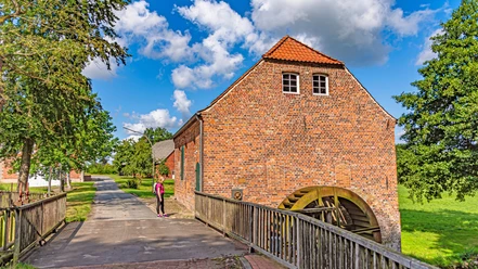
- The NORDPFAD trail begins at the Meyerhof in Scheeßel, part of the Scheeßel Local History Museum. The farmstead, idyllically situated among oak trees, consists of a main house and six outbuildings. Since 2020, the Meyerhof grounds have been home to a permanent exhibition on blue printing. In the weaver’s house, the local history association has assembled a unique collection. indigo dyeing is an ancient dyeing craft that has also been recognized as a “UNESCO Intangible Cultural Heritage of Humanity” since late 2018.
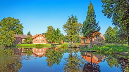
From here, a narrow walking path leads across the Beeke, through surrounding wet meadows and a residential area, until we reach the Scheeßel Heimathaus grounds with its “Low German hall house” and half-timbered buildings. The grounds are perfect for a special photo stop. We first leave the grounds through the residential area until the path turns into a narrow walking trail.
Now we walk 1.6 km along the beautiful Wümme floodplain landscape. The NORDPFAD is sometimes wider—but also very narrow. Time and again, there are great views of the Wümme flowing below. The Hohes Wümmeufer rest area and the Wümmestrand are inviting places to take a break. Paddlers often pass by here, and with a little luck, we might even spot a kingfisher.
At the end of the walking trail, we reach the L 130. We follow the bike and walking path to the left and, after 350 m, carefully cross the L 130 to the right. From there, we continue on nature trails through open farmland to the picturesque farmstead Griemshoop, which is still actively operated today.
Shortly after the “end of town” sign, we follow the dirt road on the left, which takes us through a varied agricultural landscape to Rehr , where we continue to the left. After 500 m on the walking and biking trail, we enter the Lauenbrück Forest. Soft, shady forest paths lead us through the dense coniferous forest to a fork in the trail, where in 2019 the RuheForst was established for forest burials. At the entrance to the RuheForst, which lies directly on the NORDPFAD, a large, open shelter has also been set up for visitors. This shelter, as well as the benches in the RuheForst, may also be used by NORDPFAD hikers, provided no funeral service is currently taking place there.
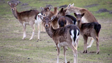
From the RuheForst, the 850-meter detour to LandPark Lauenbrück,—a barrier-free wildlife and landscape park with a café-restaurant and restrooms. A detour to Lauenbrück, approximately 1.9 km away, is also possible.
Back at the fork in the forest, the forest trail continues through dense underbrush to the B 75. There, we carefully cross the state highway and arrive at Haus Wümmetal . The We reach the sensory garden —featuring a sound station, a berry and scent trail, a pavilion, and wooden sculptures—through the foyer of the senior living and care center.
After 600 m on the walking and biking path along the B 75, we cross the road again and enter a mixed forest. In summer, giant ferns line this section of the path. At the end of the forest path, we cross a small wooden bridge. Then the vast expanse of the Vareler Heide, a classically beautiful, undulating dune landscape with broom heather and juniper. We hike through the heath along a narrow path. Here we come across the sculpture “Encounter” by artist Gisela Milse, made of Elbe sandstone. “Two people standing close together, touching, looking out into the world together. But the sculpture can also be perceived as a single person—a confrontation with one’s own inner aspects, an inner encounter,” says the artist. Scattered benches along the path invite us to rest and relax before we rejoin the main trail and reach the Vareler Heide Sheepfold , the shelter for the flock of Schnucken sheep.
For a break with a “roof over your head,” the 600 m-distant rest area “Schutzhütte Varel”, which was built in 2022 by the Vareler Heide Community Association as a volunteer effort for hikers. Finally, we reach the L 130, which we cross again. Following the familiar path, we walk along the Wümme back to Meyerhof Scheeßel. From there, a path leads to Rathauspark and the town center of Scheeßel with its numerous places to stop for refreshments and shopping.
Alternate Routes
For those who don’t want to hike quite that far, the following alternate routes are available:- Short Route (9.5 km / approx. 3.0 hours):
This route leads from LandPark Lauenbrück to the Vareler Heide and back to LandPark via Griemshoop. - Route alternative (10.7 km / approx. 3 1/2 hours):
From the Lauenbrück train station, about 2.2 km from the NORDPFAD, the route goes through LandPark Lauenbrück, the Vareler Heide, along the Wümme River, and via the Scheeßeler Meyerhof (7.2 km total) to the Scheeßel train station (another 1.3 km).
Connections to other NORDPFAD trails
A 1.6 km access trail leads from the Meyerhof to starting point 1 of the NORDPFAD Kirchsteg-Moore-Bäche.
Trail Closures
Before your hike, you should checkwww.nordpfade.de check for possible detours and trail disruptions that may occur due to flooding, storm damage, or forestry work, for example. - Short Route (9.5 km / approx. 3.0 hours):
Route markings
- Marker
The marker shows a white "N" on an orange background with the name of the NORDPFAD Wümme and Vareler Heide
Signposting
Destination signposts supplement the markings and are placed at prominent points. The signposts list places that are on the route or branch off from it, together with the distance in kilometers. The logo of the respective NORDPFADES is located underneath. Directions & Parking facilities
- Getting thereFrom the A1 or A27 highways, it takes about 30 minutes to reach the starting points, each of which has an information sign and parking available.
- Starting Point 1: 27383 Scheeßel, Meyerhof, Am Meyerhof
- Starting Point 2: 27389 Lauenbrück, LandPark Lauenbrück, Wildpark 1, about 850 m from the NORDPFAD—signposted via an access path.
- Starting point 3: 27383 Scheeßel, West Entrance to the Train Station, Am Bahnhof, 1.3 km from the NORDPFAD—signposted via an access path.
ParkingThere are three parking areas available along the NORDPFAD. The respective starting points can also be found there.- Parking Lot 1: 27383 Scheeßel, Meyerhof, Am Meyerhof
- Parking Lot 2: 27389 Lauenbrück, LandPark Lauenbrück, Wildpark 1, about 850 m from the NORDPFAD—signposted via an access path.
- Parking Lot 3: 27383 Scheeßel, West Entrance to the Train Station, Am Bahnhof, 1.3 km from the NORDPFAD—signposted via an access path.
Public transportationArrival by train- Train stations: Scheeßel, approx. 1.3 km from starting point 1, the Meyerhof, and Lauenbrück, approx. 2.2 km from starting point 2, the LandPark Lauenbrück
- "Metronom Regio" train: runs daily between Hamburg and Bremen
- Info: www.der-metronom.de
Additional information
- Komoot
We have compiled all 24 circular hiking trails in a separate NORDPFADE collection in the well-known outdoor app. The tours can also be found in the portal under the "Northern Heath" region.
Not yet on Komoot?
There is a free voucher code for new customers. The code is ROW and can be redeemed via "Redeem voucher" at komoot.de/g or via the link https://komoot.com/de-de/g?code=ROW. Literature
- The following brochures are available free of charge at local tourist information offices and at Brochure Order . They are also available for download there.
- NORDPFADE Tour Guide
This small brochure contains everything you need to know about the hiking region. - NORDPFADE Overview Map
This handy leaflet serves as a basic planning guide for the environmentally conscious. - NORDPFADE Hiking Pass
The stamp-free version for collectors.
- My NORDPFADE
Or: "It doesn’t always have to be the Camino de Santiago!"
- NORDPFADE Tour Guide
Contact person
Touristikverband Landkreis Rotenburg (Wümme) e.V.
- Ihr Ansprechpartner für die NORDPFADE und die RegionHarburger Straße 5927356 Rotenburg (Wümme)License (master data)
Touristikverband Landkreis Rotenburg (Wümme)

Author´s Tip / Recommendation of the author
Social Media