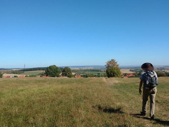
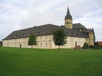
No wonder: For centuries, the Harz monasteries have shaped the cultural and economic development of the Harz region. With seven stages between 10 and 22 km and without major elevation differences, hikers immerse themselves in the world of fragrant monastery gardens, Gothic cloisters, and fascinating churches; they experience monasteries as event venues, museums, and distilleries, as special places of spirituality and as good hosts. Along the way, hikers keep the Brocken, the Harz church towers, and the gentle hills of the northern Harz foreland in view. Particularly romantic are the river landscapes along the Oker, Ecker, and Bode, and spectacular the Devil's Wall near Blankenburg and Thale. They experience the enchanting shimmer forest and hike along the former inner-German border and past fish-rich monastery ponds. Gems of Romanesque church art lie directly on the trail with the monastery churches in Drübeck and Ilsenburg, the collegiate church St. Cyriakus in Gernrode, as well as the collegiate church St. Servatius and the monastery church St. Mary in Quedlinburg. The extension to Halberstadt to the Burchardi Monastery is currently only available as a track, with signposting planned gradually in spring/summer 2024.
The Harz Monastery Hiking Trail is managed by the department Harz Monasteries, which also organizes the annual Harz Monastery Summer.
Good to know
Pavements
Best to visit
Directions
Stage 1: Goslar - Vienenburg: 14 km (Route guidance in Goslar revised as track 8.2.24)
On the way: Neuwerk Church Goslar, Grauhof Monastery, Wöltingerode Monastery
The varied 14 km section of the Monastery Hiking Trail starts at Neuwerk Church, a former monastery church with purely Romanesque architecture from the 12th century. The route guidance through the town has already been optimized digitally here and leads over the footbridge behind the "Zum Achtermann" hotel continuing to the ruins of the St. George collegiate church. From here, the trail follows the route marked on the hiking map and continues through the expansive districts of Goslar, then through forest and fields with views of the Brocken. On the trail in Grauhof, a district of Goslar, lies the Baroque monastery church St. George, dating from shortly after 1700; its significant Treutmann organ was first played in 1737. The last part of this stage runs along an old railway embankment and transforms into an avenue with fruit trees before Wöltingerode. Founded in the 12th century and remodeled in the Baroque period, the spacious and former nunnery Wöltingerode today houses an impressive historical monastery hotel and a monastery distillery that has been producing high-quality liqueurs since 1682. Stamp points: Neuwerk Church, Grauhof, Wöltingerode. Angels' benches: Neuwerk Church, Grauhof Monastery, before Wöltingerode.
Stage 2: Vienenburg - Ilsenburg: 20 km
On the way: Ilsenburg Monastery
This 20 km stage of the Monastery Hiking Trail is particularly scenic. From Wöltingerode Monastery, the trail now runs on a hillside along the Hercyniaweg on the ridge of the Harly. Place names recall the potash mine that was in operation here until 1930. Then a romantic path follows the Oker to Wiedelah, a district of Vienenburg. From there, the Monastery Hiking Trail runs along the Green Belt, the former inner-German border. The trail continues through fields to Abbenrode, then through the shimmer forest to Stapelburg. A particularly idyllic section follows along the Ecker to the meadow area of the former Jungborn spa facility. There is a special stamp point here. Over the Ilsenburg climb, it continues toward Ilsenburg. There you follow the chestnut avenue and pass through the spa park and by the lake to the market square. From there, the path leads uphill to Ilsenburg Monastery. The Romanesque monastery complex lies today in the middle of a romantic castle park.
Stage 3: Ilsenburg - Wernigerode: 12 km
On the way: Drübeck Monastery, Himmelpforte Deserted Site, St. John's Church Wernigerode
You start the 12 km stage at Ilsenburg Monastery with a beautiful view of the town. Founded around 1018, the monastery once belonged to the most influential Benedictine monasteries in the Harz region. The Sts. Peter and Paul monastery church contains unique fragments of a gypsum floor from the 12th century. The unique organ and the restored buildings of the south and east wings are definitely worth a visit. Concerts and events are also held in atmospheric rooms here. There is also a stamp point of the Harz Hiking Badge here. A stamp booklet for the Monastery Hiking Trail can easily be purchased at the local tourist information. From the monastery, the Harz Monastery Hiking Trail continues towards Drübeck through the castle park, which has been part of the "Garden Dreams of Saxony-Anhalt" since 2019. Here, silence can also be enjoyed, perhaps on one of the unique angels' benches. Then, always following the pilgrim's sign, the trail goes through the woods between Ilsenburg and Drübeck. Upon arrival at Drübeck Monastery, you can relax in the monastery café – where there is also a stamp point – or stroll through the very special and uniquely baroque-reconstructed gardens of the monastery complex. The Romanesque monastery church St. Vitus was probably built in 960. Drübeck Monastery belongs to the Protestant Church of Central Germany and today serves as a conference center, pastoral college, pedagogic-theological institute, and a wonderful retreat. This monastery complex is also part of the "Garden Dreams of Saxony-Anhalt", rediscovering historic parks in the state. You should take your time at Drübeck Monastery and definitely not miss the monastery tour. Back on the trail, it continues via Oehrenfeld towards Wernigerode. Alternatively, you can certainly make a short detour to Darlingerode, a district of Wernigerode. Darlingerode charms with beautiful nature and its cultural highlights. Particularly worth seeing are the village churches St. Laurentius and St. Katharinen or the Komturhof, first mentioned in 1468 as "curia de comtures" in the records of Ilsenburg Monastery; its homeland museum today shows life in Darlingerode in earlier times. From here, the path leads towards Ütschenteich and past the former Augustinian hermitage Himmelpforten, founded in 1253 and visited by Martin Luther. Today the complex is a deserted site. From there, the trail leads directly to the upper district of Hasserode, a district of Wernigerode. Along the tracks of the Harz narrow-gauge railway, it goes straight into the town center of Wernigerode. Through the historic Westerntor and along Westernstraße, you reach the market square of Wernigerode.
Stage 4: Wernigerode - Blankenburg: 18 km (Town route in Blankenburg newly revised as a track 8.2.24)
On the way: Michaelstein Monastery, St. Bartholomew's Church Blankenburg
This 18 km stage is challenging; Wernigerode alone is worth a longer stay. The town hall in its current well-known form dates from 1540 and annually attracts countless visitors. The trail goes now across the old town towards Lustgarten. The park belongs to the overall ensemble of Wernigerode Castle, which towers high above the town. A detour to St. John's Church, which in its Romanesque core is the oldest preserved church in Wernigerode, is worthwhile; an angels' bench invites you to rest. Leaving town, the trail runs along the forest edge towards the Wolfsholz settlement. The Monastery Hiking Trail crosses the main road and continues along the Austberg towards Benzingerode. Shortly before the village, the Austberg tower, a watchtower built around 1250, offers a wonderful view over the Harz foreland. In Benzingerode, the trail passes the striking church built around 1900 in Neo-Romanesque style, with wall paintings inside. A paved path leads below the Struvenberg and Ziegenberg. After crossing the main road between Heimburg and Elbingerode, the trail continues on a gravel path downhill towards Michaelstein Monastery. Founded in 1146, the monastery still lies away from urban life. Until the 16th century, Cistercian monks lived, prayed, and worked here. Today, the premises house the Saxony-Anhalt Music Academy; the cloister buildings and monastery garden are accessible to the public. A forest path leads past the Bastteiche ponds and over the Eichenberg, from where you can enjoy a lovely view over Blankenburg. Arriving in the Flower Town, the new digital track guides you between St. Bartholomew's Church and the Tourist Information Centre through the old town along Hohe Straße and Winde Street to the Small Castle and the baroque gardens. The Tourist Info on the back of the building is also home to the Harz Hiking Badge administration. Be sure to visit the baroque gardens from the Tourist Info in Blankenburg!
Stage 5: Blankenburg - Thale: 10 km (Town route in Thale newly revised as a track 8.2.24)
On the way: Wendhusen Monastery
This approximately 10 km stage is the shortest but presents some hiking challenges that can be managed with average fitness. Starting at the service office of the Harz Hiking Badge and the Tourist Information in Blankenburg, after a detour into the baroque gardens, the trail leads onto the south slope path below the Devil's Wall, a unique geological rock formation. The path continues on the south slope with a rewarding view of the Hamburger Wappen, another striking and widely visible rock formation on the outskirts of Timmenrode. After passing through Timmenrode with its 18th-century village church, the route follows field and forest paths to the Eggerode forest house. From there, the trail stretches to Thale, where the stage destination, Wendhusen Monastery, is reached on Rosstrappenstraße. Wendhusen Monastery, dating back to the Carolingian period, is the oldest in the area of today's Saxony-Anhalt and dates to the 9th century. The impressive west wing was built just before 1200; in 1540 the monastery was converted into a manor. Today the complex hosts the Nordharz Antiquities Society e.V. with lecture series, tours, and traditional archery.
Stage 6: Thale - Quedlinburg: 20 km
On the way: Collegiate Church St. Cyriakus Gernrode, Collegiate Church Quedlinburg, St. Mary’s Monastery on Münzenberg
From Wendhusen Monastery in Thale, the Monastery Hiking Trail leads along Wendhusenstraße to Schänkeplatz and further to Neustädter Straße. At Knieberg, it heads towards Neinstedt up to the Devil's Wall parking lot. The Monastery Hiking Trail marker can be followed. Then, the trail crosses the Bode bridge to Marienhof with its farm shop. Crossing the pedestrian traffic light over the street, the trail continues over the railway crossing to Alte Quedlinburger Straße. At the end, Neinstedt main street is crossed, and opposite the trail continues into the narrow street "Am Brunnen". Via a steep staircase, St. Catherine’s Church is reached. There you are rewarded with a wonderful view of the Devil's Wall and the Brocken. The village church was first mentioned in records in 1236; its exact age is unknown. In 1564 it was extended and rebuilt. The trail continues on the poetic path towards Stecklenberg, a district of Thale. At the end of Schulgasse, the trail continues straight, passing the church and the model of the now-destroyed Lauenburg (marked: 3-Castles-Path) – the ruins of Stecklenburg and Lauenburg lie slightly above Stecklenberg – then gently uphill into the forest. The trail slowly approaches the road. Before the house "Waldesruh" the trail leads down to the street, then uphill again (Stecklenberg main street; be sure to watch the traffic here!). At the end of the left curve, the hiking trail turns into the forest and leads to Bad Suderode to the town hall square and the spa park. On the Selke Valley Trail / German Kings and Emperors Hiking Trail (panorama route – Menzingteich – Hagental – Im Hagen – Am Spittelteich), the Harz Monastery Hiking Trail also leads to the over thousand-year-old Romanesque collegiate church St. Cyriakus in Gernrode. Extensively renovated in the second half of the 19th century, the impressive church features architectural highlights inside with the "Holy Grave", the eastern crypt, and the two choir sections. From the guesthouse "Bückemühle", follow the Selke Valley Trail marking to Quedlinburg up to Münzenberg, a district of Quedlinburg with over 60 half-timbered houses and a wide view over Quedlinburg. Here, at the former St. Mary’s Monastery, the Harz Monastery Hiking Trail ends or begins. Before concluding the discovery tour through Quedlinburg, you can take a break behind the Sheep Bridge on an angels' bench.
Stage 7: Quedlinburg-Halberstadt: 22 km (Currently only available as a track, new map print 4/24, status 8.2.24)
On the way: Spiegelsberge Landscape Park, Halberstadt Cathedral and Cathedral Treasury, Burchardi Monastery with John Cage Organ Art Project
This stage connects the World Heritage city Quedlinburg with the former bishopric city Halberstadt. Following the footsteps of St. James, the hiker encounters unique viewpoints such as Steinholzwarte or the legendary Glass Monk in the Thekenbergen. The ridge trail over the Harsleber hills connects Steinholz with the wild-romantic Thekenbergen and promises spectacular sight lines to Königsstein near Westerhausen, the Harz foreland, or the distant towering Brocken.
The route continues into the picturesque Spiegelsberge and the historic landscape park. Established nearly 250 years ago, landmarks such as the Belvedere Tower or the Spiegel Mausoleum bear witness to the once-rich park architecture. One of the most outstanding buildings in the park is the hunting lodge from 1782. While enjoying a magnificent panoramic view over Halberstadt from its rear terrace, the lodge houses a real superlative in its cellar: a gigantic giant wine barrel with a capacity of 144,000 liters.
The cathedral square in the heart of the city offers a unique ensemble of Romanesque Liebfrauenkirche, Gothic cathedral, and the baroque curiae of the former cathedral canons. In particular, the cathedral built after French models and its unique cathedral treasury make hearts beat faster. The Halberstadt Cathedral Treasury is one of the most valuable church treasures outside the Vatican and encompasses numerous valuables from 13 centuries.
Passing timber-framed art spanning five centuries, the trail continues to the Burchardi Monastery. Along the way, cultural hikers frequently come across traces of Halberstadt's Jewish history. In the Berend Lehmann Museum, interested visitors can learn all about one of the formerly largest Jewish communities in Central Europe.
After crossing the Holtemme River by the so-called Poet's Path, you encounter the thick walls of the over 1,000-year-old Burchardi Monastery. Founded by the Cistercians, the Romanesque St. Burchard Church today houses the John Cage Organ Art Project, the slowest musical piece in the world. The composition by the US-American avant-garde artist John Cage is performed according to the directive "as slow as possible" and lasts a total of 639 years.
Total distance: approx. 116 km
Equipment
Weather-appropriate clothing and sturdy footwear
License (master data)
Map
Harz Monastery Hiking Trail - Official Map for the Pilgrimage Route
1st edition April 2020. Info boxes with descriptions of the monasteries and sights, scale 1 : 30,000, UTM grid for GPS, contour lines in 20m intervals, Harz Club hiking trails, stamp points, special stamp points for the Monastery Hiking Trail, angels' benches, elevation profile format 110 x 200 mm, 990 x 600 mm (open), printed on high-quality map paper Price: €5
Harz Hiking Badge - Companion booklet Harz Monastery Hiking Trail
12 stamp points along the Harz Monastery Hiking Trail can be recorded with this companion booklet. Price: €2.50;
Nearby
