In Bad Harzburg, the host town of the 114th German Hiking Day 2014, the Emperor's Route begins. Before starting the hike, a visit to the castle ruins on the Burgberg is worthwhile. According to legend, in 1073 Henry IV fled through a secret passage in the castle well along the Emperor's Route to escape the Saxons.
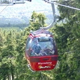
You reach the starting point of the hike by the Burgberg cable car or via Herzogweg. From Antoniusplatz, where the Saxons camped nearly 1000 years ago to conquer Harzburg, the route leads over Säperstelle and Reuschenteich to Molkenhaus. At the Hopfensäcke, two typical granite cliffs of the Harz, we reach the highest point of the Emperor's Route. Then you reach the former Oderbrück inn and the Emperor's Route leads from there through the Oder source area, partly over medieval cobblestones. You reach the Königskrug inn, cross the B4, and walk along the Old Harzburg Road past Braunlage and Lausebuche to reach Kapellenfleck. Here you find the remains of a chapel of misery from the early Middle Ages, a combination of hostel and chapel. Over the Helenenruh wayside cross, you shortly thereafter reach the town of Walkenried and the Cistercian monastery there. From there, the route runs eastwards and joins the Karst Hiking Trail. You cross the border to Thuringia, and via Juliushütte, Ellrich, and the Mittelbau-Dora memorial camp you reach the North Thuringian town of Nordhausen. In medieval times, there was a royal court here frequently visited by German kings up to the late Staufen period. Then the route goes from Nordhausen via Heringen and Hamma into the Badraer Switzerland, from whose mountains there is a wonderful view of the Harz. The route then finally leads over the Kyffhäuser to Tilleda in Saxony-Anhalt, where it ends at the royal palace there.
Good to know
Pavements
Best to visit
Directions
Bad Harzburg Antoniusplatz - Säperstelle - Reuschenteich - Echoplatz - Molkenhaus - Luisenbank shelter - Hopfensäcke - Oderbrück - Königskrug - Old Harzburg Road - Lausebuche - Kapellenfleck - Helenenruh - Walkenried Cistercian monastery - Juliushütte - Ellrich - Wolffleben - Mittelbau-Dora memorial camp - Nordhausen - Heringen - Hamma - Auleben - Badra - Kyffhäuser monument - Königspfalz Tilleda
Directions & Parking facilities
Paid parking is available at the valley station of the Burgberg cable car and at the large car park on the B4.
Direct connections from Bad Harzburg station:
Hanover (via Goslar, Hildesheim)
Brunswick (via Vienenburg, Wolfenbüttel)
Göttingen (via Goslar, Seesen, Kreiensen, Northeim)
Halle (Saale) (via Vienenburg, Ilsenburg, Wernigerode, Halberstadt)
Holzminden (via Goslar, Seesen, Kreiensen)
Additional information
Regional Association Harz e.V.
Hohe Straße 6
06484 Quedlinburg
Tel: 03946 96410
rvh@harzregion.de
www.harzregion.de
License (master data)
Map
The Harz in 4 parts hiking and cycling maps Upper Harz, Central Harz, East Harz, South Harz scale 1 : 30,000, UTM grid for GPS, contour lines in 20m intervals, subtle shading, Harz Club hiking trails, signposted cycling routes, MTB and cycling tour recommendations plastic cover, format 115 x 205 mm ISBN 978-3-936185-76-8 price: €14.80
The South Harz - hiking and cycling map scale 1 : 30,000, UTM grid for GPS, contour lines in 20m intervals, Harz Club hiking trails, signposted cycling routes, MTB and cycling tour recommendations format 110 x 200 mm, 990 x 600 mm (open) ISBN 978-3-936185-75-1 price: €4.00
The High Harz - hiking and cycling map scale 1 : 30,000, UTM grid for GPS, contour lines in 20m intervals, Harz Club hiking trails format 110 x 200 mm, 990 x 600 mm (open) standard edition (map paper) ISBN 978-3-928977-91-3 price: €4.00
Nearby

