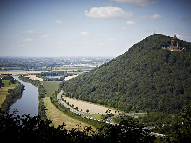
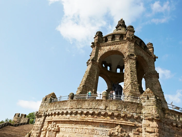
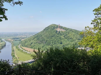
The idyllic half-timbered town of Rinteln in the Weser Renaissance style is the starting point of the last stage for hikers on the Weserbergland-Weg. Here, you can once again explore the narrow streets of Rinteln's cozy old town center before the path winds up the last section to the Wülpker Egge. Nearby is the Kleinenbremen visitor mine, where you can experience the history of regional mining up close. Via lonely forest paths, the Weserbergland-Weg then reaches the state border with North Rhine-Westphalia, the third federal state on the 225 km long overall route. Shortly afterwards, the hiker reaches the "Porta Kanzel," a viewing platform from which the end point of the Weserbergland-Weg is not far: The monumental Kaiser Wilhelm Monument towers visibly on the opposite Weser bank. Here, the Weserbergland-Weg ends; the Weser breaks through the low mountain range and flows out into the North German Plain.
Good to know
Pavements
Best to visit
Directions
Narrow alleys, picturesque corners, and entire rows of colorful half-timbered houses: this is Rinteln. Anyone entering the historic marketplace here for the first time will surely be amazed. The cohesive ensemble of restored half-timbered houses has remained in its original form since the 13th century. Just settle down in one of the many cafés, bistros, and restaurants and enjoy the atmosphere among the magnificent buildings from the Weser Renaissance period. Or take a night watchman tour, where the secrets of these houses can be discovered in a special way.
From Rinteln, the Weserbergland-Weg winds uphill towards the Wülpker Egge. The mountain, visible from afar, is 268 meters high. North of the Wülpker Egge lies the small village of Kleinenbremen. A visit to the visitor mine is worthwhile here, where you can experience the history of mining and the formation of the earth up close.
Through lonely forest paths, where you can enjoy peace and relaxation, you reach the Lower Saxony state border with North Rhine-Westphalia in the middle of the forest. With this, you have reached the third federal state on your hiking journey along the 225-kilometer-long Weserbergland-Weg, beside Hesse and Lower Saxony. Shortly after "the border," you reach the Porta Kanzel, a viewing platform laid out in 1877. From here, your stage destination is already in sight: Porta Westfalica.
Equipment
Sturdy footwear is required. In summer, you should bring sufficient water.
Directions & Parking facilities
Information on different travel options can be found here.
Further information is available from local tourist offices and in our interactive map.
Information on public transport on the Weserbergland-Weg can be found here.
Additional information
Literature
Service booklet: The Weserbergland-Weg, with map excerpts, route description as well as hotel and gastronomy tips. Available free of charge at http://www.weserberglandweg.de
License (master data)
Weserbergland Tourismus e.V.
Author´s Tip / Recommendation of the author
Stroll through Rinteln's picturesque old town or dive into the world of mining at the visitor mine in Kleinenbremen.
Safety guidelines
Good sure-footedness is needed in some places. Divide the path into stages according to your strength. It can be slippery in some places when wet.
Map
Map "Weserbergland-Weg," current route guidance, access paths, and other forest and hiking trails, dimensions: 11 x 18.5 cm, paperback (TB), German, scale: 1:50000 Publisher: Kompass ISBN 978-3-85026-861-5
Interactive map "The Weserbergland Navigator," digital route guidance, altitude profiles, and GPS tracks. Here is the Weserbergland Navigator.
Nearby


