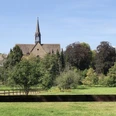
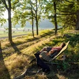
The fifth stage takes the hiker from Schönhagen to Silberborn in the Hochsolling. Right at the start of the stage, the path leads to the "Experience Forest." Under the motto "Human-Forest-Culture," the Experience Forest offers exciting and varied stations where there is plenty to discover for young and old. The highlight is Lower Saxony's first treehouse hotel. A total of nine treehouses await hikers for a unique overnight stay. The path continues along the Ahletal valley with its colorful wildflower meadows up to the Ahle spring, which invites you to cool down your overheated hiking feet. Next is the village of Neuhaus, where a visit to the wildlife park is highly recommended. You can see lynxes, wolves, and deer here, and an inn invites you to take a hiking break. The next destination at the edge of the Weserbergland Trail is the Hochsolling Tower, which offers wonderful views before the path reaches the stage destination Silberborn in the Hochsolling.
Good to know
Pavements
Best to visit
Directions
From the idyllic town of Schönhagen, the Weserbergland Trail leads you to the "Experience Forest". Under the motto "Human-Forest-Culture," the Experience Forest offers exciting and diverse stations. From the "living" forest to the "historical", the "scientific", the "fairy-tale", as well as the "mysterious" and "adventurous" forest, there is much to discover for both young and old. The highlight of the Experience Forest is Lower Saxony's first treehouse hotel. The treehouse hotel has nine treehouses, all insulated and equipped with compost toilets, electricity, and heating. After this eventful rest, you hike north along the forest edge; always with the beautiful Ahletal valley with its colorful wildflowers in view. Uphill past the Ahle spring, whose fresh and cool water is especially refreshing for your hiking feet on hot summer days, the Weserbergland Trail leads to the intermediate destination of Neuhaus in Solling. Particularly worth seeing in Neuhaus is the Wildlife Park House of the Lower Saxony State Forests at the entrance to the wildlife park. The Solling Visitor Center offers numerous information on hiking trails, sights, and the special features of the nature park in the Solling-Vogler region. The attached Café Bistro Rotwild takes care of your physical well-being. After this short break, a visit to the nearby wildlife park is worthwhile. Here you can observe various wild animals such as lynxes, wolves, and deer in their spacious enclosures, or birds of prey and owls in the falconry. At the edge of Neuhaus, the Weserbergland Trail then winds along diverse, natural paths to the Hochsolling Tower. From here, you can enjoy a fabulous view of the wide nature of the Weserbergland. The stage destination is the village of Silberborn, known for Lower Saxony's most valuable living raised bog, the Mecklenbruch raised bog.
Equipment
Sturdy footwear is required. In summer, you should bring enough water.
Directions & Parking facilities
Information about different arrival options can be found here.
Further information is available from the local tourist information centers and in our interactive map.
Information on public transport on the Weserbergland Trail can be found here.
Additional information
Literature
Service booklet: The Weserbergland Trail, with map excerpts, route descriptions as well as hotel and gastronomy tips. Available free of charge at http://www.weserberglandweg.de
License (master data)
Weserbergland Tourismus e.V.
Author´s Tip / Recommendation of the author
Go on a discovery tour in the Experience Forest or enjoy the fabulous view from the Hochsolling Tower.
Safety guidelines
At some points, sure-footedness is required. Divide the route into stages according to your strength. It can be slippery at some places when wet.
Map
Map "Weserbergland Trail", current routing, access paths, and other forest and hiking trails, size: 11 x 18.5 cm, paperback (TB), German, scale: 1:50000 Publisher: Kompass ISBN 978-3-85026-861-5
Interactive map "The Weserbergland Navigator," digital route guidance, elevation profiles, and GPS tracks. Here you can access the Weserbergland Navigator.
Nearby


