- 3:30 h
- 12.50 km
Hiking the Müden Heath Loop
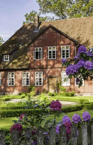
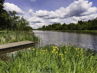
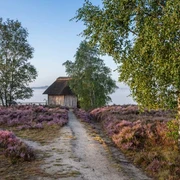
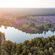
For many visitors, it is the most beautiful place in the Südheide: the half-timbered village of Müden (Örtze). Around Müden (Örtze) there is a varied landscape that is just begging to be hiked. Heath. Forests. Streams. Meadows. All the beauty of the heath.Our hiking trail, the Heideschleife, starts at the historic watermill on the Örtze. The path leads through a park to the Heidesee lake in just a few meters. Artificially created almost 50 years ago, it has developed into a gem. Dragonflies and butterflies, ducks and geese, reeds and water lilies.
The Heidesee is fed by the Örtze river. The narrow hiking trail meanders along its banks from the river-forest adventure trail to Poitzen. Fallen trees, overgrown with moss. Clear waters of the Örtze. Water plants sway in the current. Frogs croak from neighboring ponds. Small boggy patches. Alders. Birches. Willows. Reeds. Marsh plants. A path by the water could hardly be more entertaining. Hiking is fun here.
From the large meadow in front of Poitzen, it goes up to the bridge. Through the settlement to the edge of the forest. Light birch trees alternate with pines. The path rises imperceptibly. The Eitzberg between the Örtze and Wietze rivers is 85 meters high. With low-growing plants in the adjacent fields, the view can sweep far across the Örtze valley. We walk along the edges of the forest down into the Wietze valley and to the wooden bridge. Picturesque river crossing in the forest. The view of the leisurely flowing water is calming. A bench in the shade.
The Drei-Steine-Weg leads to the Wietzer Berg: Flebbe-Stein (Fritz Flebbe, painter and graphic artist, died in Müden in 1929). Linde-Stein (local historian from Hamburg, 1860 -1926). Lönsstein (Hermann Löns, heath poet, 1866 - 1914). The striking and mighty Lönsstein is the landmark of the Wietzer Berg, at 102 meters the highest point of the Heideschleife.
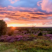
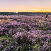
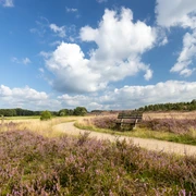
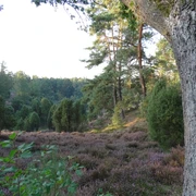
Beautiful views of the Örtzetal valley between Müden (Örtze) and Hermannsburg. Together with the Heidschnuckenweg trail, the hiking trail winds its way down through the heath to the parking lot, offering great views. Down at the edge of the heath along Wietzer Berg. Dense, shady coniferous forests. Forest edge path. Then the outskirts of Müden (Örtze).
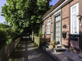
The path along the Wietze leads to the footbridge and the village center. The free-standing St. Laurentius Church has a varied architectural history dating back to the 12th century as a boulder church. Surrounded by beautifully restored half-timbered farmhouses. Farm cafés and restaurants. Buckwheat cake or Heidschnuckenkeule? Time for a leisurely finish, as it is only a few hundred meters to the starting and finishing point at the historic watermill.
Length of the hiking trail: 12.5 km
Duration: approx. 3.5 hours.
Starting point: Historic watermill Unterlüßer Str. 5, 29328 Müden (Örtze), alternatively hiking parking lot below the Lönsstein (Hermannsburger Str. 20, 29328 Müden (Örtze)).
IMPORTANT: Diversion in Müden due to upcoming construction work on the bridge in or from the direction of Poitzen. Please pay attention to the detour signs and maps. You can download the PDF file for orientation. The GPX data has been corrected and includes the detour.
Parking: Parking lot at Unterlüßer Str. 5, 29328 Müden (Örtze)
Transport connections:
CeBus line 220 coming from Hermannsburg, stop Willighausen (Wietzer Berg) or stop Müden Bahnhof (Historische Wassermühle). Coming from Unterlüß, CeBus line 261 and line 220 (change in Faßberg) or Bürgerbus Faßberg. Stop Müden train station.
Tourist Information:
- Tourist Information Müden, Unterlüßer Str. 5, 29328 Müden (Örtze), Tel. 05053 989222
Accommodation & Gastronomy max. 2 km away:
You can find a detailed list of restaurants and accommodation in the PDF "Accommodation and restaurants" to download at the bottom of this page.
Good to know
Best to visit
suitable
Depends on weather
License (master data)
Lüneburger Heide GmbH
Our recommendations
Nearby
