Otter-Pfad Wahrenholz Süd

- 0:35 h
- 9.33 km
- 9 m
- 10 m
- 52 m
- 65 m
- 13 m
- Start: Wahrenholz railroad station, 29399 Wahrenholz
- Destination: Wahrenholz railroad station, 29399 Wahrenholz
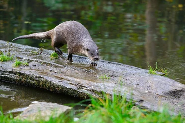
Always on the trail of the otter, this otter trail leads from Wahrenholz to the south. The trail and the stations along the way offer many opportunities to experience nature. The four stations focus on topics such as fish and sheep farming.
A total of four otter trails invite you to experience the landscape from an otter's perspective. The otter is a very rare and secretive animal. It reacts very sensitively to changes in its habitat. In other words, if streams, rivers, ponds and lakes are in a good ecological condition, they will sooner or later be colonized by otters as habitats. The otter has returned to the lowlands of the Ise, a small river in the district of Gifhorn, thanks to extensive nature conservation measures. Wild otters and their tracks have even been spotted near the Otter Center in Hankensbüttel.
The otter trails lead into these areas to raise awareness of otter habitats. A total of 24 stations equipped with steel otters invite visitors to learn about the life of the water otter and nature conservation directly on site.
Further information on the otter trails and an accompanying brochure are available from the Otter Center.
A total of four otter trails invite you to experience the landscape from an otter's perspective. The otter is a very rare and secretive animal. It reacts very sensitively to changes in its habitat. In other words, if streams, rivers, ponds and lakes are in a good ecological condition, they will sooner or later be colonized by otters as habitats. The otter has returned to the lowlands of the Ise, a small river in the district of Gifhorn, thanks to extensive nature conservation measures. Wild otters and their tracks have even been spotted near the Otter Center in Hankensbüttel.
The otter trails lead into these areas to raise awareness of otter habitats. A total of 24 stations equipped with steel otters invite visitors to learn about the life of the water otter and nature conservation directly on site.
Further information on the otter trails and an accompanying brochure are available from the Otter Center.
Good to know
Best to visit
- suitableDepends on weather
Directions
- The Otter Trail starts at the train station in Wahrenholz. At the end of the small road leading from the station, turn right. (Station 1)
The Otter Trail follows the road in the direction of "Weißes Moor". At the left-hand bend, turn right onto a paved path which crosses a ditch at its end. Turn left there. (Station 2)
Continue along the forest path over the small wooden bridge. Then turn right into the small tarred road
. Turn right at the crossroads and immediately left again. Cross the Sauerbach stream
and then turn right at the end of the path. At its end, turn right. Follow the sandy path to the left as far as the stable building, then turn right onto the bridge. (Station 3)
The Otter Trail follows the path that leads to the right before the railroad tracks. (Station 4) Equipment
- A bicycle helmet should be part of your gear for the tour. It's a good idea to bring snacks for the ride.
Directions & Parking facilities
- Getting thereParkingParking spaces are available at the train station in Wahrenholz.Public transportationReiseauskunft Deutsche Bahn: https://www.bahn.de
Busverbindungen Verkehrsgesellschaft Landkreis Gifhorn GmbH: https://vlg-gifhorn.de
Bitte beachten Sie, dass es regionale Unterschiede bei der Fahrradmitnahme gibt. Daher sollten Sie sich vor Fahrtantritt über besondere Bestimmungen informieren. License (master data)
Südheide Gifhorn GmbH

Author´s Tip / Recommendation of the author
Wahrenholz:
- Water mill
- "Heiliger Hain" heath area
Safety guidelines
- The tour also runs partly on field and forest paths, so appropriate riding technique is required.
Bicyclists, horse riders, joggers and walkers like to use paths and areas that are primarily used for agricultural and forestry purposes. This often leads to misunderstandings between recreational users and farmers. Observing simple rules of conduct can facilitate relaxed coexistence in fields and meadows. Please show consideration for each other! Map
- Weitere Infos zu den Otter-Pfaden und eine Begleitbroschüre gibt es hier:
https://otterzentrum.de/natur-hautnah-erleben/otterpfade/