- 6:00 h
- 20.55 km
- 340 m
- 340 m
- 305 m
- 475 m
- 170 m
- Start: Parking lot at the end of Silberborn in the direction of Dassel
- Destination: Parking lot at the end of Silberborn in the direction of Dassel
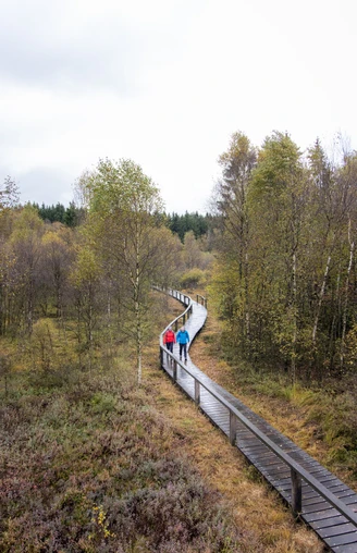
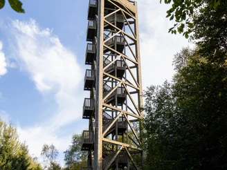
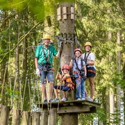
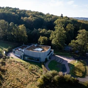
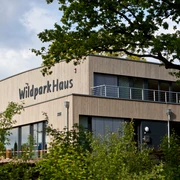
From the start, the route follows the August Müller Trail to the Mecklenbruch raised bog. This is crossed on a wooden footbridge. At the high ropes course, take a sharp right and follow Schießhäuser Straße to the next junction. Then turn left and follow Torfhüttenstraße down to the B 497. Shortly before the main road, turn left onto the hiking trail along the B 497. After 250 m, cross the main road and continue downhill along Mühlengrund to Fohlenplacken. In the center of the village, turn right and then immediately left again. The hike leads up Kohlgrund to the L 549 and continues along this road to Neuhaus. From here, continue along the Derentaler Weg and later turn left down to the Ahlequelle spring. Then cross the B 497 and take the Ahlequellenweg to the right, parallel to the main road, to reach Neuhaus Wildlife Park. Follow the path past the paddock to Eichenallee. Follow this uphill to the right until you reach Trakehner Weg. Follow this downhill to Dölmeweg, turn left towards Neuhaus and then right behind the stud wall via Ludwig-Ilse-Weg up to Hochsollingturm. Via the LiebesBankWeg, past the Moosberghütte, via the Annemonenweg back to the start.
Waypoints
Good to know
Pavements
Best to visit
Directions
Ausgangspunkt ist der Parkplatz am Ortsausgang Silberborn in Richtung Dassel. Von hier aus geht es auf dem August Müller-Weg zum Hochmoor Mecklenbruch. Dieses Naturschutzgebiet von einzigartiger Flora und Fauna wird auf einem Holzsteg überquert. Weiter führt der Weg durch einen Hochwald zum Hochseilgarten. Dort wird scharf rechts abgebogen und der Schießhäuser Straße bis zur nächsten Kreuzung gefolgt. Danach geht es links ab, auf der Torfhüttenstraße hinunter bis an die B497 heran. Kurz vor der Bundesstraße wird links auf den Wanderweg an der B 497 abgebogen. Nach ca. 250 Metern wird die Bundesstraße überquert und es geht weiter bergab den Mühlengrund hinunter bis Fohlenplacken. In der Ortsmitte Fohlenplackens wird rechts abgebogen und gleich wieder links auf den Wanderweg N 4 oberhalb Fohlenplackens. Die Wanderung führt in der Kohlgrund hinauf bis zur Landstraße 549 und folgt dieser weiter bis Neuhaus. Von hier aus geht es weiter auf dem Derentaler Weg und später links ab, auf den Wanderweg N 1 hinunter zur Ahlequelle. Dann wird die B497 überquert und rechtsseitig parallel zur Bundesstraße auf dem Ahlequellenweg wird der Wildpark Neuhaus erreicht. Von hier aus geht es über den Weg an der Pferdekoppel zur Eichenallee. Dieser wird rechts ab bergauf gefolgt bis zum Trakehner Weg. Über den Trakehner Weg geht es hinunter bis zum Dölmeweg, links in Richtung Neuhaus und dann hinter der Gestütsmauer rechts über den Ludwig-Ilse-Weg hinauf zum „Aussichtsturm Hochsolling“. Von hier aus geht es über den LiebesBankWeg, an der Moosberghütte vorbei, über den Annemonenweg und durch Silberborn bis zum Ausgangspunkt zurück.
Directions & Parking facilities
In Neuhaus: Am Wildpark, Wildpark 1 oder am Parkplatz Wildenkiel, Ecke Derentaler Straße.
In Fohlenplacken: Fohlenplackener Str., gegenüber vom Hotel Waldschloß.
Additional information
Solling-Vogler-Region im Weserbergland e. V.
Lindenstr. 8
37603 Holzminden/Neuhaus
Tel.: 05536 960970
info@solling-vogler-region.de
www.solling-vogler-region.de
License (master data)
Author´s Tip / Recommendation of the author
The water in the Ahle spring is of drinking water quality and invites you to recharge your batteries.
Nearby
