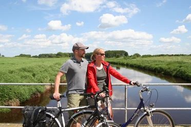
Energie-Entdecker Route Mittelweser (Nordroute)

- 2:48 h
- 43.50 km
- 82 m
- 76 m
- 19 m
- 63 m
- 44 m
- Start: Weserstrasse
- Destination: Weser Wall
Why do we see lightning during thunderstorms? How is electricity generated? What are renewable energy sources? How is biogas produced? What are energy crops? The Mittelweser Energy Discovery Trail provides answers to these questions.
The approximately 100-kilometer route is divided into a northern route (43 km) and a southern route (65 km). It connects 21 energy sites in the Middle Weser region, where various forms of energy production are showcased.
Along the route, facilities and projects for generating electricity from wind, water, and solar energy are explained—from historic windmills and watermills to modern wind turbines. Photovoltaic systems and a solar fueling station in Lower Saxony illustrate the use of solar energy. At the hydroelectric power plant in Drakenburg, visitors can see how electrical energy is generated by damming the Weser River.
The route is supplemented by information on combined heat and power plants and biogas plants with various utilization concepts.
You can also find the Energy Discovery Route on Komoot.
Safety instructions:
- Please note that throughout the entire tour, you use the bike paths at your own risk
- No guarantee is provided regarding the usability of the bike paths
- In cities, extra caution is generally advised
- Please use existing bike paths
- Dangerous areas, such as bollards, barriers, and unsecured crossings of state highways, are to be expected along the route—this warning applies in particular to families with small children who are cycling.


Good to know
Best to visit
License (master data)
Mittelweser-Touristik GmbH
Our recommendations

.jpg")

Nearby


Download GPX file